Ilet à Cabrit
Ilet à Cabrit
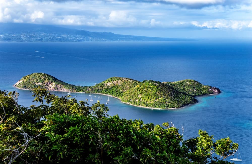
A small uninhabited island 1 km from Terre-de-Haut, Ilet à Cabrit combines the remnants of Fort Josephine, dry forest and sheltered coves in the Les Saintes archipelago.
Ilet à Cabrit is a small uninhabited island located approximately 1 km from Terre-de-Haut, in the Les Saintes archipelago. Free of cars and permanent residents, it blends 18th-century military ruins, dry forest, cactus savanna and coves ideal for swimming. It can be reached by boat from Terre-de-Haut in just a few minutes.
Why visit Ilet à Cabrit?
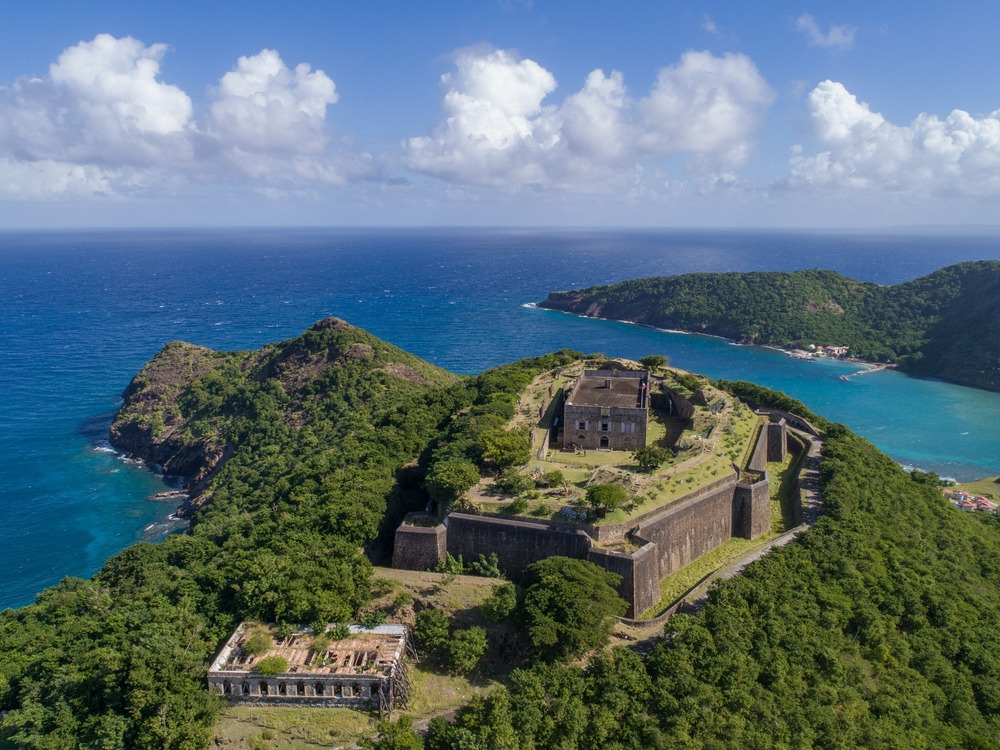
The island's appeal lies in its dual identity: a well-preserved historical site featuring the ruins of Fort Josephine perched at 85 m above sea level, and a protected natural space where endemic species of Les Saintes circulate. Visitor numbers remain moderate compared to Terre-de-Haut, making it a peaceful stop for those wishing to hike, observe wildlife or picnic away from the village.
The island marks the entrance to Les Saintes Bay and defines two natural passages, the Whale Pass to the east and the Sugarloaf Pass to the south, which serve as access points to the Terre-de-Haut harbor.
History of Fort Josephine
The islet long served as a surveillance post thanks to its strategic location. In 1777, France built the Queen's Fort at the summit of the Pointe de Sable mound. The structure was later renamed Fort Josephine and complemented the defensive system of Les Saintes alongside Fort Napoleon and the Tête Rouge battery.
In 1809, the English took Les Saintes, maintained the fort and added a cistern. After Guadeloupe returned to French administration, the site changed function: it became a penitentiary in 1851. A hurricane largely destroyed it in 1865, but convicts continued to pass through en route to Cayenne until 1902.
In 1871, a lazaretto was established below the fort to welcome immigrants from French India, recruited to replace formerly enslaved people freed in 1848. Today, only ruins remain and can be freely explored.
What to see and do on the islet
Compact geography
The islet stretches approximately 1.2 km east to west and 750 m north to south, with a summit at 85 m above sea level. Three points cut its coastline: Pointe à Cabrit to the west, Pointe de Sable to the south and Pointe Bombarde to the east. Between them open three coves: Anse sous le Vent, Anse du Bananier and Anse du Petit Étang, where swimming is possible in calm seas.
Military remnants
The climb to Fort Josephine is made on foot via a trail that ascends to the summit of the Pointe de Sable mound. Stone walls, the cistern added by the English and the remains of the lazaretto below are visible. The site is neither fenced nor guarded: it can be visited freely, keeping in mind the fragility of the ruins.
Flora and fauna
The island's volcanic soil supports dry forest dominated by Bois Savonnettes and Poiriers pays trees. Near the shore grow Manchineel trees, whose sap and fruit are toxic: do not shelter beneath them during rain nor touch their fruit.
As for wildlife, the islet is home to two species endemic to Les Saintes: the Terre-de-Haut anole, a small lizard, and the Les Saintes racer, a harmless and rare snake. Hummingbirds, yellow warblers and moustached vireos can also be observed in the understory.
At higher elevations, cactus savannas bordering the cliffs serve as nesting zones for several seabirds: tropicbirds, bridled terns and ospreys.
Practical information
- Visit duration: allow 2 to 4 hours on site to combine the climb to the fort and swimming time.
- Equipment: closed-toe shoes for the trail, plenty of water (no water sources on the islet), hat, sunscreen, snorkel and mask.
- Food and drink: no shops on the islet. Plan a picnic and take all waste with you when leaving.
- Swimming: possible in wind-sheltered coves, unsupervised. Watch out for Manchineel trees along the beach.
When to visit
The most favorable period runs from December to April, during the dry season: calmer seas, more comfortable crossings and low hurricane risk. The hurricane season runs from June to November, with a peak in September-October when some boat services may be cancelled. For hiking to the fort, it's best to start early in the morning to avoid the hottest hours.
How to reach Ilet à Cabrit
The islet can only be reached by sea from Terre-de-Haut. Several options exist: maritime shuttles offered by local service providers, boat excursions with a skipper, or boat rental. The crossing takes approximately ten minutes. There are no developed pontoons; disembarkation is directly onto the beach, usually at Anse sous le Vent.
To reach Terre-de-Haut, regular maritime services depart from Trois-Rivières and Pointe-à-Pitre on mainland Guadeloupe.
Nearby attractions
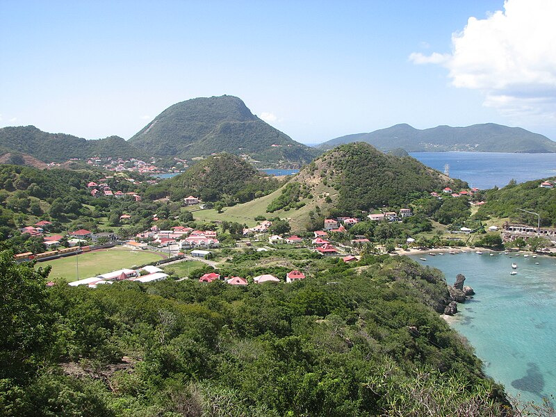
Once back in Terre-de-Haut, Fort Napoleon, perched at 114 m above sea level at the summit of Morne Mire, complements a visit to Ilet à Cabrit well: it houses a museum and offers wide views over the archipelago. Access is via a 20 to 30-minute walk from the landing.
On neighboring Terre-de-Bas island, Poterie Fidelin is the only historical monument of the location. Linked to slavery and the sugar industry, it is discovered through its ruins by the sea. Terre-de-Bas also offers four marked trails:
- Trace des Falaises (yellow): 6.8 km, approximately 3 hours, 240 m elevation gain.
- Trace du Dessus de l'Étang (blue): 2.1 km, approximately 1 hour, 240 m elevation gain.
- Trace du Pied de l'Étang (red): 1.8 km, approximately 45 minutes, 180 m elevation gain.
- Trace du Morne (orange): 1.7 km, approximately 45 minutes, 180 m elevation gain.
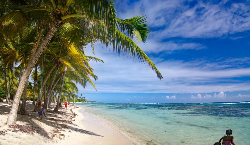
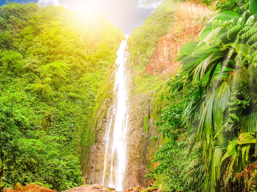
On Basse-Terre, the Carbet Falls and Grande Anse Beach are among the other classic stops on a Guadeloupe trip.
Frequently asked questions
Frequently asked questions
Only by sea from Terre-de-Haut, located approximately 1 km away. Maritime shuttles, boat excursions and boat rentals enable the crossing, which takes about ten minutes. Disembarkation is directly onto the beach.
Allow 2 to 4 hours on site to combine the climb to the ruins of Fort Josephine and swimming time in one of the coves.
Yes, in sheltered coves like Anse sous le Vent or Anse du Bananier. Swimming is unsupervised. Watch out for Manchineel trees present along the beach: their sap and fruit are toxic.
No. The islet is uninhabited and has no shops, water sources or reception facilities. You must bring water, a picnic and sun protection, and take all waste with you when leaving.
From December to April, during the dry season, the sea is calmer and hurricane risk is low. The hurricane season from June to November can result in cancellations of crossings.
Planning your visit
Ilet à Cabrit fits naturally into a circuit around Les Saintes, itself associated with broader exploration of the archipelago. To build an itinerary combining Les Saintes, Basse-Terre and Grande-Terre, consult our suggestions for travel in Guadeloupe.
Nearby
Interested in this visit?
We can include it in your personalised itinerary.